Only licensed or registered land surveyors are authorised and entitled to performing surveys that define and mark the boundaries of your property. At Greenfield Geodetics we have strategic partnerships with registered professional land surveyors who provide the following services and expertise:


Cadastral Surveys
Cadastral or land Surveys
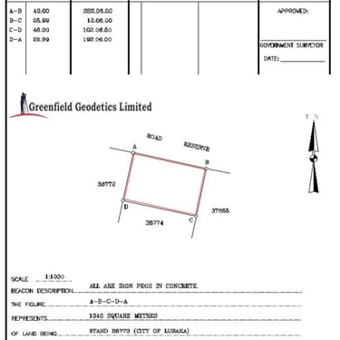
Required in order to define and record the extent of property ownership (Survey Diagram).
Carried out for the purpose of acquiring a 99 year lease (Cerfiacte of Title).
Subdivision (Residential, Commercial and Industrial)
At Greenfield Geodetics we can provide with you with surveys to design your proposed subdivision such as site analysis surveys and detail surveys.
We can also help you divide a tract of land into smaller parcels from initial application to final survey.
Beacon Location
We can help you locate your beacons for the purpose of knowing the extent of your land.
The Service provides the location and verification of existing beacons, stations and reference marks.


Conversion of Customary Land to State Land
Convert your customary land (Farm or Plot) to state land and get your 99-year leasehold (Certificate of title) by having your land surveyed and following the procedure described below....


